
The wave watcher
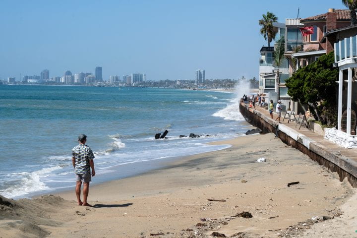
High tides and large waves have impacted California's coastline -- including this portion of Long Beach -- during this 2026 El Niño.
Henri Drake, UC Irvine assistant professor of Earth system science, is a physical oceanographer who studies circulation patterns, tides, waves and other ocean dynamics. He’s particularly interested in observing what’s happening now through the spring of 2027 as we are experiencing a historically strong El Niño. Will California’s coastline bear the brunt of heavy surf and high tides combined with abnormally high sea surface temperatures? Drake and his colleagues are using advanced computer models to predict El Niño outcomes, as he explains in this episode of the UC Irvine Podcast.
Brian Bell:
This episode is a continuation of our El Niño series. As we have covered in previous installments, El Niño centers on abnormally high sea surface temperatures in the tropical Pacific Ocean. This buildup of warmer water starts in the late spring and gathers strength into the winter months. In the past, strong El Niños have resulted in heavy rainfall in the Southwestern United States.
UC Irvine researchers are working to monitor the impacts of this year’s El Niño. Will we get a lot of precipitation in Southern California? How will that be experienced in flood-prone inland areas and along our coasts? In addition to El Niño, are there other causes for the high tides and heavy surf that we have already experienced along the Southern California coast this year?
UC Irvine Assistant Professor of Earth System Science Henri Drake is a physical oceanographer who studies ocean dynamics, including globe-spanning circulation patterns, tides, and waves. In this special episode of the UC Irvine Podcast, Professor Drake will share his knowledge and insights into the movements of the ocean in this exceptional El Niño year. Our conversation with Professor Henri Drake is up next.
Professor Henri Drake, welcome to the UC Irvine podcast.
Henri Drake:
Yeah, great to be here.
Bell:
We’re going to talk today about oceans and, this is part of our El Niño series and the ocean really is the central force in El Niño. Is it not?
Drake:
Yeah. In collaboration with the atmosphere, let’s say.
Bell:
Tell us a little bit about your research into ocean waves. You study waves of different varieties, the ones that crash on our shore, Kelvin waves, the tides. What is behind all of this movement of ocean water?
Drake:
Yeah, so I wanted to start by just clarifying that all of these types of waves that we hear about in the ocean, they’re really part of one big spectrum of ocean waves. So the, the physics of a wave is pretty simple. You have water that piles up somewhere for some reason, and then gravity wants to pull it down. And so you have these pressure gradients that push it away, and that’s how the wave propagates. And then how exactly that wave propagates, so how fast it goes, you know, where, what direction it’s propagating in, that all depends on the different scales of the wave. So a wave that is really short, like the waves that crash on a beach, what we mean by the length of a wave is how long is the distance between the two peaks of a wave? So the waves crashing on a beach, maybe it’s just 100 feet or something between each successive wave.
That’s what we would call in that case, a short wave. But then you can have other waves that are really long, like a tsunami. It could be, you know, tens of miles between different peaks. And so those are both what we call gravity waves in the sense that gravity is trying to pull the water down and push it forward. They’re the same type of wave, they just act differently because they’re different sizes. And so Kelvin waves are another example of one of these waves. They’re a bit different because they’re so large, they’re so long that they’re actually affected by Earth’s rotation. And what that means is that they’re very sensitive to processes that affect Earth’s rotation. So for example, one special place is the equator. The equator is special because it’s the point on Earth that is rotating the fastest. If you think about it, it has the biggest circumference to move as the planet is rotating.
Whereas if you go up to the poles, the north and south pole are barely moving at all because they’re right on the rotation axis, right? And so what this means for the ocean dynamics is that these types of waves, these kelvin waves get kind of trapped at the equator and they propagate and it turns out that the way the physics work, they only move eastward. So what that means is if you have something that creates some disturbance at the equator, we think of like winds blowing on the ocean, that can kind of create this wave that builds up there. Because it happens on the equator, it’s forced to only propagate eastward. And so that is why we have things happening in the Tropical Pacific that propagate eastward, they hit the coast of the Americas, and then they kind of transition and become a different type of Kelvin wave or a coastally trapped wave.
So, this is because the coasts also kind of act to stop the effects of rotation in a certain way. And so it forces the waves to then go north along the coast of California, Baja California and California in the northern hemisphere, but then also they kind of break down and go south along the South American coast as well.
Bell:
Once it hits the continental landmass, it sort of bunches up, I would imagine.
Drake:
Well, it bunches up, but actually it just keeps propagating. So these waves that they come across the Pacific, they sort of bunch up along the California coast, but actually they keep propagating all the way to Oregon, Washington, Alaska. They can even make it all the way to Japan, for example.
Bell:
Go all the way up and around.
Drake:
Yeah, and actually they can just keep going all the way back to the equator and they keep just going in loops like that.
Bell:
So it’s almost like a circulation pattern in a way, in a way.
Drake:
Totally. I mean, they, they lose some energy and they can kind of leak out some of the energy as they go, so they get weaker and weaker and eventually dissipate, but they just keep propagating as waves.
Bell:
So how does sea surface temperature influence these waves?
Drake:
Yeah, that’s right. So the, the waves that we usually think about, like tsunamis and waves crashing on a beach, these are kind of the simplest type of a gravity wave where they pile up and then gravity wants to pull them down. Where the temperature comes in is the fact that how dense water is a function of the temperature. And so what this means is that you generally have lighter, warmer waters near the surface of the ocean and denser waters below that. And it turns out that because gravity acts differently depending on the density of these, you can actually have waves with a vertical structure. So, what happens with Kelvin waves during El Niño is it’s actually not a kind of full depth Kelvin wave. It’s a Kelvin wave that’s kind of trapped near the surface that’s essentially because you have this relatively warm water and it propagates, it’s a slightly slower wave.
So instead of propagating as fast as a tsunami, which would reach the coast within hours, a Kelvin wave, because it’s this much vertically shorter wave that’s trapped by these temperature anomalies, it propagates much slower. So it takes weeks or months to reach the Americas and then up to California.
Bell:
Let’s talk about tides. How, how do tides work and what is a king tide we’ve been hearing about in the news lately?
Drake:
Yeah, sure. So tides are also a type of gravity wave in the sense that they’re affected by gravity just like these other waves. The difference is that they have an extra force that’s affecting them on top of forces like gravity and the fictitious force of Coriolis, which is Earth’s rotation. So they have this extra force, which is the tidal potential, which is the fact that, you have the moon and the sun, which have their own gravity fields that are pulling on the ocean. And so the thing is that they, the moon is slightly different distances from different points on Earth, right? So if you’re on the, the far side of Earth from the moon, you’re actually a little bit further away from the moon. So the gravity you feel is a bit weaker than on the close point to the moon. And that differential gravity that you feel from these celestial bodies, the moon and the sun, that is what gives rise to tides.
And, so, the water wants to basically bulge up. You actually get two bulges. So one wants to bulge up near the moon or the sun, another bulge wants to kind of pile up the opposite direction. And then these bulges want to kind of stay locked with those celestial bodies, but then the earth is rotating under these bulges. And not just that, but then you have continents that kind of run up against these bulges. And so that’s where you get this really complicated pattern of tides and why they happen either once or twice a day. So a king tide is the fact that the orbits are not perfectly spherical or circular, right? So there are times when the moon and the sun are a bit closer to Earth. And so, and also when the, the two orbits kind of line up. And so a king tide is kind of when all of these astronomical forces kind of line up so that you get the strongest possible tides.
Bell:
That’s fascinating. And so we are expecting actually a big king tide event later this month in November 2026. Is that right?
Drake:
Yeah, I think that’s right. And unfortunately, it’s happening the same time as we have these higher levels due to El Niño. And so those kind of just add up on top of each other.
Bell:
Let’s talk again about El Niño. We have, we’re in the midst of a very large, very strong El Niño, right now. What is the impact you’re seeing as an oceanographer on the Pacific Ocean right now from El Niño?
Drake:
So, so one of the, the big things is that the water is just a lot warmer. And so we know from past El Niños that when you have much warmer water in the open ocean Pacific, but also along the coast of the Americas, that you have really large impacts on ecosystems. So, one of the things that I do is I’m part of this NOAA, so National Ocean Atmospheric Administration. They have a marine ecosystems task force. So I’m one of the members of this task force, and we’ve been having a lot of meetings about trying to forecast not just what are the physical impacts of the El Niño going to be on things like sea levels along California and, and rainfall events and storms later this year, but also the ecosystem impact. So what is this going to mean for our fisheries or for harmful algo blooms, these kinds of things.
Right now, I think we’re kind of in this transition zone where really what we’re limited to being able to say is expect it to be kind of like what past big El Niños have been in terms of the impacts. But where we’re moving as a field is developing predictive models. So we have these models of how ocean circulation works, how ocean temperature works. We also have now computational models of ecosystems. So, you know, how phytoplankton take energy from sunlight and, and how they’re affected by ocean temperatures. And so the field is working on building predictive models to actually be able to predict when is there going to be more food for fish? When are there going to be these harmful algal blooms? And so that’s kind of a moment of transition for our field where people are building these predictive models, but we’re still kind of evaluating them and understanding whether they have enough skill to be useful.
Bell:
And that influences climate change because phytoplankton absorb carbon dioxide from the atmosphere, et cetera. Totally.
Drake:
Yeah.
Bell:
You recently received a grant from the Packard Foundation. Explain what you’re going to do with those funds.
Drake:
Yeah. So the, the goal of that project is to connect some of the global scale climate dynamics work that my group has been doing. So in addition to this work on, on El Niño that we talked about, we also work a lot on global ocean currents, like the Atlantic Meridional Overturning Circulation that people sometimes hear about and how these interact with the rest of the climate system. So the atmosphere, ice sheets, sea ice, et cetera. And so far my group has been doing this at a global scale. So we build these global predictive models and try to get some insights into what these systems might look like in 10 or 100 years. But what we’re trying to do with this project is really hone in on what this means for sea levels along the coasts. And what this means is taking the best information we have about predicting the future at the global scale and then successively downscaling that.
So zooming in more and more on exactly what’s going on at the coasts, but doing this in a kind of physically consistent way. So we, essentially, we take the information from the global model and we use that to set up these smaller and smaller scale models until we’re simulating what’s going on with flooding in a particular city, for example.
Bell:
We’re here in Southern California, not far from the UC Irvine campus is Newport Beach, San Clemente, Dana Point, a lot of places that have been impacted by flooding, coastal flooding in the last few months. So as you as a researcher, are you able to go to some of these locations or you talk about drilling down to local regions, you know, you’ve got it right in, at your doorstep practically.
Drake:
Yeah, yeah, definitely. And I, I’d like to eventually get down to, you know, actually looking at the, the flood impacts in the future along California. We’re starting with this project. It’s, it’s a five-year project, so we’re starting at the global scale and then we’ll successfully zoom in over time. But yeah, I’m, I’m from California. I’m from San Francisco Bay Area and my, we have a family group chat and my, my family’s constantly saying like, “Hey, can you do a simulation of the San Francisco Bay Area? Like this highway that we use to commute is always flooding. Like is that going to get worse?” So those are the kinds of things that I want to be able to actually give useful information about.
Bell:
It’s a personal impact.
Drake:
Yeah, for sure.
Bell:
Professor Henri Drake thank you for joining me on the UC Irvine Podcast today.
Drake:
Yeah, it’s been a pleasure. Thanks so much.
Bell:
You can read more about Assistant Professor Henri Drake’s ocean research at news.uci.edu. While you’re there, please check out the other episodes of our special El Niño podcast series.
The UC Irvine Podcast is a production of Strategic Communications and Public Affairs at the University of California Irvine. Please subscribe wherever you get your podcasts. I’m Brian Bell. Thank you for listening.