
ESS55
Prof. Jin-Yi Yu
Visible Image
qA visible satellite image represents sunlight scattered or reflected by objectives on
Earth.
qDark areas represent geographic regions where small amounts of visible light from the Sun are reflect back to space, such as oceans.
qWhite areas represent snow or clouds.
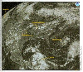
(from Meteorology: Understanding the Atmosphere)