Typical Weather Pattern
for Lake-Effect Snowstorms
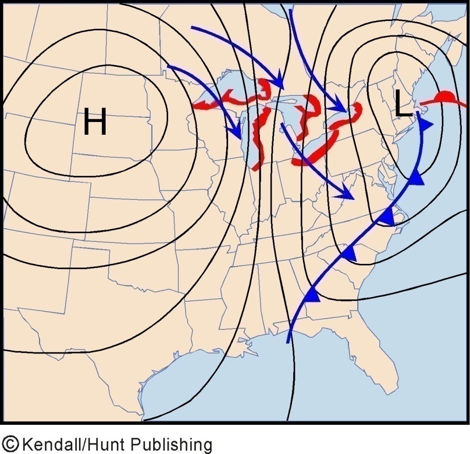
qVery cold air must move across a lake surface for lake-effect snowstorms to develop.
qThe warmer the lake temperature and the colder the air, the more extreme the lake-effect
snows will be.
qThis temperature contrast happens most often between late November and mid-January.
qTypically, lake-effect snow begins after an extratropical cyclone has passed over the region and the cyclone’s cold front is
well east of
the Great Lakes.
qThe strength of this flow is enhanced if an arctic high has moved into the central US.
qUnder these conditions, strong pressure gradient develops across the lakes and drive cold air southeastward from Canada to produce the lake-effect snowstorms.
Snow belts