‹#›

ESS124
Prof.
Jin-Yi Yu
South of the Cyclone Center
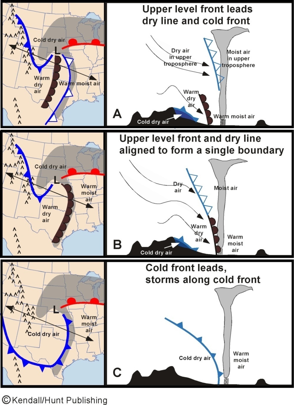
•Three airmasses at the surface and an additional airmass aloft; three scenarios could occur,
•Scenario A: Warm moist air from the Gulf extends to the dry line at the surface and
to the
upper-level front aloft. Lifting ahead of the front aloft produces a line of thunderstorms and showers. If the moist
air ahead of the dry line is unstable enough,
a second
line of thunderstorm may occur ahead of the dry line.
•Scenario B: Dry line and upper-level front form a single boundary and produce wether ahead of the dry line.
•Scenario C: This happens when the Canadian cold front moves rapidly to take over the dry line. Weather will be
produced ahead of
the cold front.