‹#›

ESS124
Prof.
Jin-Yi Yu
Initial Movement of the
Cyclone at Surface
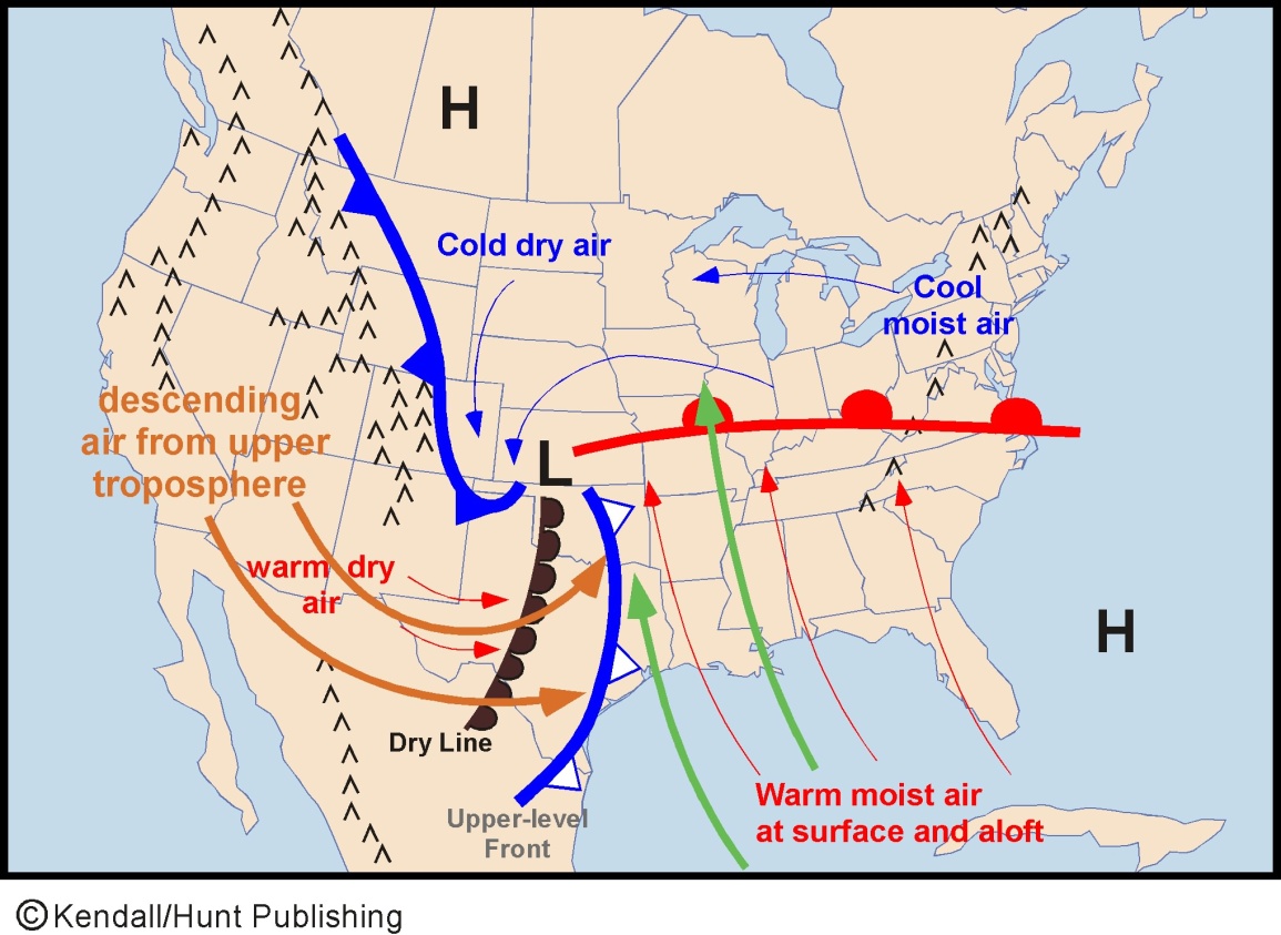

•East and south of the low-pressure center, warm and humid air from the Gulf of Mexico move northward to form the warm front.
•To the southwest of the low, a dry line develops as desert air from southwest flow eastward, desceds the Rockies into the Great Plains and meet moist air from the Gulf.
•Cold air typically lies along the east slope of the Rockies
northwest of the low-pressure
center, and later flows southward to the west of the low center.
•The cold air is not deep enough to cross the Rockies and stays
between the Rockies
and the low center, whose leading edge is a cold front.
•An upper-level front forms at 700mb, where the dry, descending
upper tropospheric
air on the west of the jetstreak meets the northward-flowing moist air in the upper and middle
troposphere.
300mb
chart