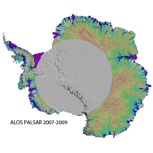
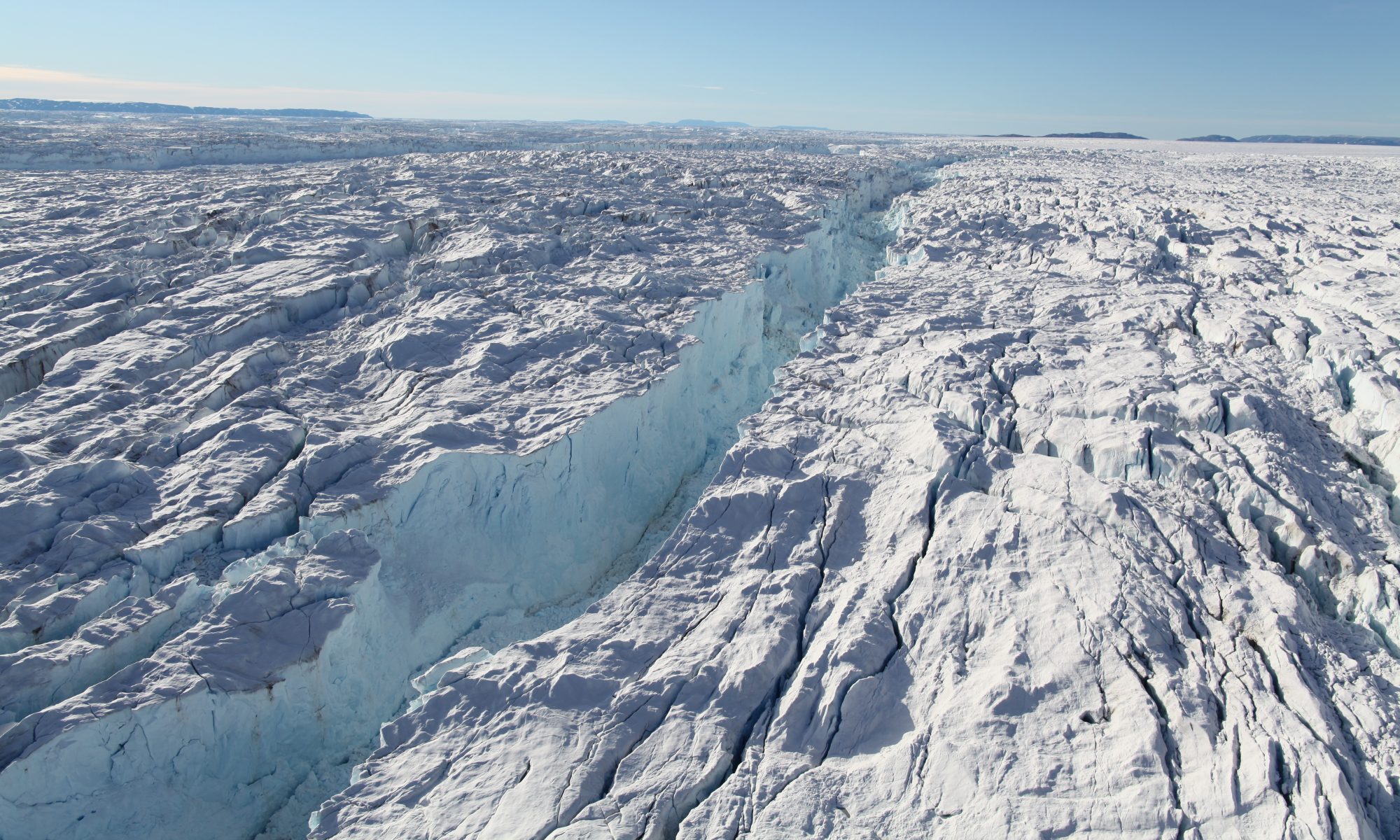
News

Ice velocity changes in the Ross and Ronne sectors observed using satellite radar data from 1997 and 2009

We report changes in ice velocity of a 6.5 million km2 region around South Pole encompassing the Filchner-Ronne and Ross Ice Shelves and a significant portion of the ice streams and glaciers that constitute their catchment areas. Using the first full interferometric synthetic aperture radar (InSAR) coverage of the region completed in 2009 and partial coverage acquired in 1997, we processed the data to assemble a comprehensive map of ice speed changes between those two years.

Ice flow in Greenland for the International Polar Year 2008-2009

We present a new, reference, comprehensive, high-resolution, digital mosaic of ice motion in Greenland assembled from satellite radar interferometry data acquired during the International Polar Year 2008 to 2009 by the Envisat Advanced Synthetic-Aperture Radar (ASAR), the Advanced Land Observation System (ALOS)'s Phase-Array L-band SAR (PALSAR) and the RADARSAT-1 SAR that covers 99% of the ice sheet in area. More detail here.

ISSM open-source release

The Ice Sheet System Model, modeling software developed as a collaboration between JPL and UCI, is now officially released. See the ISSM site for details.

Ice velocity map and grounding line of Antarctica based on SAR interferometry now available for download from NSIDC

Map of AntarcticaTwo new Earth System Science Data Records, which were generated at the Department of Earth System Science at the University of California, Irvine in collaboration with Caltech's Jet Propulsion Laboratory, are now available for download at NSIDC:

Animation: Flow of Ice Across Antarctica

These animations shows the motion of ice in Antarctica as measured by satellite data from the Canadian Space Agency, the Japanese Space Agency and the European Space Agency, and processed by NASA-funded research from the University of California, Irvine. The background image from the Landsat satellite is progressively replaced by a map of ice velocity, which is color-coded on a logarithmic scale.

Scientists map huge rivers of Antarctic ice flowing into the seas in climate change "breakthrough"

Huge rivers of ice that flow into the sea from deep within Antarctica have been mapped for the first time.

The breakthrough could be crucial in tracking future sea levels as part of the battle against climate change, according to the scientists who undertook the study.

A team led by Professor Eric Rignot from the University of California at Irvine produced a 'jigsaw' of the glacial formations using data from European, Japanese and Canadian satellites.

Polar melting: UCI hosts global ice project planning meeting

Climate scientists from across the nation are gathering at UC Irvine this week to plan the next phase of an ambitious campaign: using planes to map the planet’s dwindling polar ice.

The prognosis is bad. Sea levels already are rising in part because of ice loss; the losses at both poles appear to be accelerating; and projections strongly suggest that it’s only going to get worse.

See the full news story at http://www.ess.uci.edu/news/brennan201106.

Melting Ice Sheets Now Largest Contributor to Sea Level Rise

The Greenland and Antarctic ice sheets are losing mass at an accelerating pace, according to a new NASA-funded satellite study. The findings of the study -- the longest to date of changes in polar ice sheet mass -- suggest these ice sheets are overtaking ice loss from Earth's mountain glaciers and ice caps to become the dominant contributor to global sea level rise, much sooner than model forecasts have predicted.

See the full story at http://www.ess.uci.edu/news/searise201103

Ice Bridge: An Airborne Mission for Earth's Polar Ice

Professor Eric Rignot describes the science objectives of NASA's IceBridge Mission

Warmer ocean speeding Greenland glacier melt

UCI/NASA study finds submarine erosion plays major, previously overlooked, role.

Glaciers in West Greenland are melting 100 times more rapidly at their end points beneath the ocean than they are at their surfaces, according to a UC Irvine/NASA study published online this week in Nature Geoscience.

See full story at http://www.ess.uci.edu/news/20100217rignot

Measuring melting ice sheets

Scientist Eric Rignot to speak on how warmer climate and water are changing topography in Antarctica and Greenland.

Global climate change - especially as it relates to glacial melting and rising ocean levels - is the subject of much debate and research.

Eric Rignot, Earth system science professor, studies ice sheet melting in Antarctica and Greenland. He will talk about his work 8-9 a.m. Tuesday, March 31, as part of the 2008-09 Discover the Physical Sciences Breakfast Lecture Series.